Cyclone Burevi: Director General of Meteorology explains the latest situation
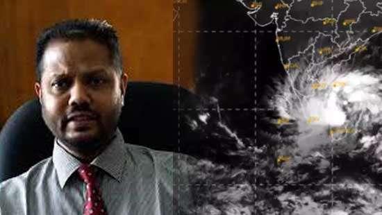
Cyclone Burevi, which entered the island off the the coasts is currently flowing near the shores of Mannar, Athula Karunanayake, Director General of Meteorology Department said, speaking to a private television channel at 6.30 am this (03) morning.
“Cyclone Burevi entered the island from 10.30 – 11.30 last night off the coasts of Kuttuveli and Tiriyai and flew towards Mannar via Vavuniya. This is currently moving close to the coast of Mannar. Rainfall of over 200 mm occurred in some places, and the wind speed rose up.”
“Given today’s situation, its direct impact is seemingly being declined. It does not mean that there are no showers, or winds. But when this leaves the island another phenomenon could occur. A situation in which the sea waves from Puttalam to Poonaryn are coming ashore again could occur,” the Dept Director General revealed, adding that there is no need to be unduly alarmed that this could be a tsunami.
“There may be rising tides,” he added, “in addition, the sky could be cloudy in the northern part of the island. Rainfall of up to 150 mm may occur in some places. The wind speed could also drop down, but at a speed of between 70 – 80 kmph.”
As the adverse weather condition could continue to affect on the coast, Karunanayake urged the fishermen community not to go fishing in the deep and shallow seas of the North and the Northeast, warning that it could be dangerous